Hast-o-Bood Part-27

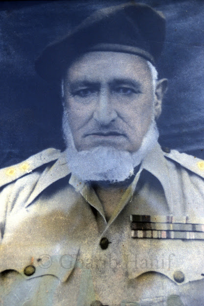
Maharaja Hari Singh (Last Ruler of Jammu and Kashmir)
In the history of the subcontinent, the reorganization of the Muslim League and the war for the acquisition of Pakistan under the enthusiastic leadership of Quaid-e-Azam Muhammad Ali Jinnah Rah also created enthusiasm and longing for freedom among the Muslims of the state. Now, according to the need of the hour, the Muslim Conference was formed and thus the Kashmiri people under the leadership of their beloved leaders Sardar Abdul Qayyum, Sardar Muhammad Ibrahim, Chaudhry Ghulam Abbas, Mr. KH Khurshid, Mir Waiz Muhammad Yusuf, Mir Waiz Muhammad Farooq etc. Jump into action. Maharaja Hari Singh tried his family prescription. The guerrillas were fired upon several times and on various occasions, but it was impossible to build a sand barrier in the face of the floods. With the announcement of the formation of Pakistan, the military-trained pensioners of Bhimber, Poonch, Kotli, Gulpur, Tharuchi and the western part of the state snatched the territory of present-day Azad Kashmir from the cowardly Dogra forces of the state by force. When Maharaja Hari Singh saw his victory by the sword as impossible, he fled from Srinagar to Jammu and continued to conspire with his Indian sympathizers to establish a treaty with Pakistan. Eventually, against the wishes of the overwhelming majority of his subjects, he signed a deed of unnatural accession to India on October 27, 1947, seeking military aid and fleeing to Delhi in the shadow of the Sangins. Thus a chronic tragedy befell the Kashmiri Muslims.
He performed the rite of fidelity well
Not from us, but it is true
Not from us, but it is true
According to the 1941 census of the State of Jammu and Kashmir, the total population of each of the two provinces of Jammu and Kashmir was 4,21,616. In which the population of Kashmir province was 24,183. While Jammu province had a total population of 191,433. The area of Kashmir Province is 63,554 square miles and the area of Jammu Province is 12,378 square miles.
The state of Kashmir has strong economic, social, religious, commercial, cultural and natural waterways and is located in the far north of Pakistan. Its river channels run through the Punjab and towards India. The Indus River is definitely related to Pakistan. The Jhelum, Chenab, Ravi and Beas rivers also flow through Pakistan. Prior to the partition of the country, all the timber of Kashmir was transported by river to the Punjab via Jhelum and Chenab. The only rail link of the state with the state of Jammu was also from Sialkot [Punjab] Pakistan. Bad roads also connected Kashmir to the rest of the world from the entire province of Punjab, which kept Kashmir open to trade with the outside world all year round. Here are some of them: [1]. From Rawalpindi to Koh-i-Muri, from here to Kohala, from there to Baramulla, then to Srinagar. Total distance one hundred and thirty two miles. It is also called Badshahi Rasta or Pir Panjal Rasta. Now that the state has been divided between the two countries as Azad Kashmir under a temporary arrangement and the issue of this disputed issue is yet to be decided, it is no longer possible to use this highway. Along the way, Pakistani tourists are unable to enjoy the scenery, rivers and waterfalls and the clear water of the springs. In addition to this long mountain journey, more than two thousand large bridges of many small bridges have been built over the canals.
The route from Gujarat [Punjab] in the state of Kashmir is from Gujarat to Bhimber, 28 and a half miles, from Bhimber to Syedabad 14 miles, from Syedabad to Nowshera 12 miles, from Nowshera to Chingas 14 miles, from Changs to Rampur Rojuri 14 miles, Rajouri 14 miles from Thana Mandi, 10 miles from Behran Gullah, 10 miles from Bushiana to Boshiana, 11 miles from Boshiana to Aliabad Sarai, 13 miles from Aliabad Sarai to Hirapur, 8 miles from Hirapur to Shopian, 12 miles from Shopian to Ramu. And eighteen miles from Ramu to Srinagar.
Another route from Rawalpindi Sihala to Kahuta, 30 miles from Kahuta to Lachhman Patan, 15 miles from Lachhman Pattan to Pallandri, 15 miles from Pallandri to Helan, 12 miles from Helan to Hajira, 10 miles from Hajira to Poonch, 16 miles from Poonch to Aliabad, 16 miles from Aliabad. Ori seventeen miles, Ori to Rampur fourteen miles, Rampur to Baramulla fourteen miles, and Baramulla to Patan seventeen miles, Patan to Srinagar seventeen miles.
There is also a road from Sialkot to the state. Before Sialkot, they used to go to Jammu by train. After the partition of India, the Pakistani territory still runs to Chak Amro [Shakargarh Tehsil, Sialkot District]. One hundred and fifteen miles from Sialkot to Chak Amro, from Chak Amro to Jammu, and then forty miles from Jammu to Udhampur, thirty five miles from Udhampur to Butt, thirty three miles from Batot to Ram Soh, twenty three miles from Ram Soh to Verinag, Islam from Verinag 17 miles from Abad and 34 miles from Islamabad to Srinagar, 20 miles from Jhelum district via Mirpur, 34 miles from Mirpur to Kotli Mangralan, and 27 miles from Kotli to Poonch, and from Poonch to Sihala district of Rawalpindi as mentioned above. He used to reach Srinagar.
to be continued ....
[1] Guides of Kashmir, author Muhammaduddin Fouq
[2] Guides of Kashmir, author Muhammaduddin Fouq
[2] Guides of Kashmir, author Muhammaduddin Fouq
Note: Blogger does not necessarily agree with the text of the book.


Comments
Post a Comment